
 visit raa.com.au
Of the 40 schools soon to receive the reduced speed limit, 24 have an existing speed and red-light camera at the location (across 21 sites), which will be able to issue offences at the reduced speed limit once signposted.
Only four of the existing 119 schools have a fixed camera at the location.
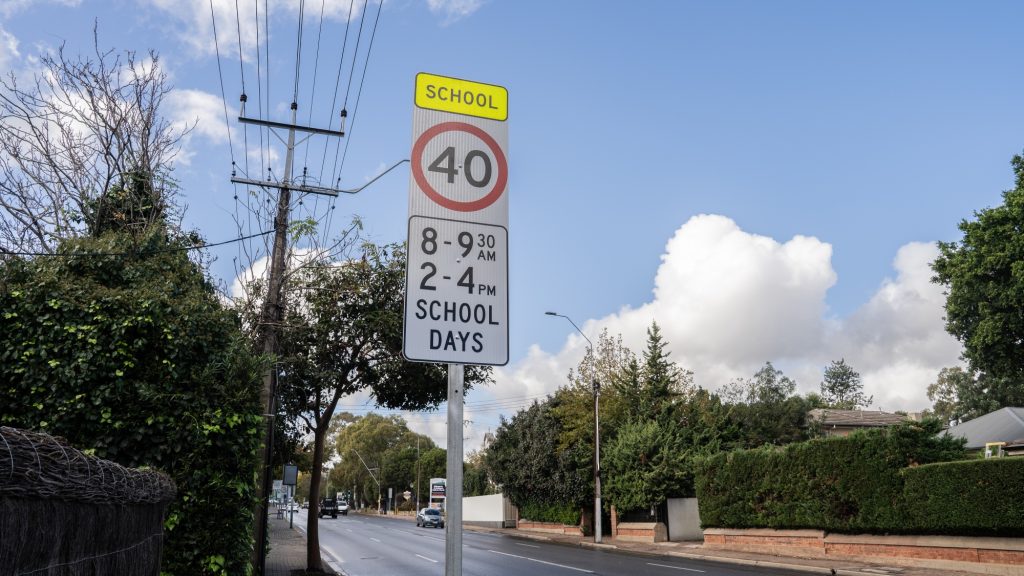
These sites will also receive flashing speed limit signs to show when the 40km/h limit is in operation – between 8:00am-9:30am and 2:00pm-4:00pm on government school days.
Created by RAA, the interactive map shows both existing and upcoming locations across the state, and which locations currently have a fixed camera.
Prominent new locations include Portrush Road at Linden Park Primary School, Shepherds Hill Road at Blackwood High and Primary Schools, and Main North Road / Regency Road at Our Lady of the Sacred Heart College – all of which have fixed cameras.
It comes as students return to school for Term 4 this week, with the time-based limit already in place at 119 schools across the state.
Explore the locations in the map below
RAA Senior Manager Road Safety and Infrastructure Charles Mountain encouraged drivers to explore the map to see where time-based school speed limits are located along their daily commute.
“With 40 more schools getting the time-based limit in the coming months, now is a good time for drivers to check where they are and when they apply,” Mr Mountain said.
“These sites are on arterial roads that thousands of South Australians drive every day, so even if you think you know your route well, there may soon be a new time-based speed limit on it.
“Children are some of our most vulnerable road users – they’re smaller, harder to see and can be unpredictable near roads, so slower speeds give drivers more time to react if a child steps out unexpectedly.
“Even a small reduction in speed can make a big difference to the severity of a crash, and that’s what these limits are all about.”
The 40km/h time-based limit applies where signposted on main roads near a school. It does not affect 25km/h school zones on local roads, which apply whenever children are present, even on non-school days.
RAA interactive time-based speed limits map can be accessed at https://daily.raa.com.au/sa-time-based-school-speed-limits-map/index.html
Schools set to receive a 40km/h time-based speed limit by the end of 2026
For a full list of locations visit the Department of Infrastructure and Transport website.

In South Australia, 25km/h school zones operate on local roads 24 hours a day, seven…
Running across three days, the program will bring together Year 10-12 students from more than…

Motorists are being urged to plan their journeys around road closures this Sunday, 20 September,…